Bogdkhan National Park. Bogd Khan Uul Biosphere Reserve. Tsetseegum, Chingeltei, Songino Khairkhan and Bayansurkh mountains.
THE REGIONS OF MONGOLIA
SIGHTS OF INTEREST IN MONGOLIA
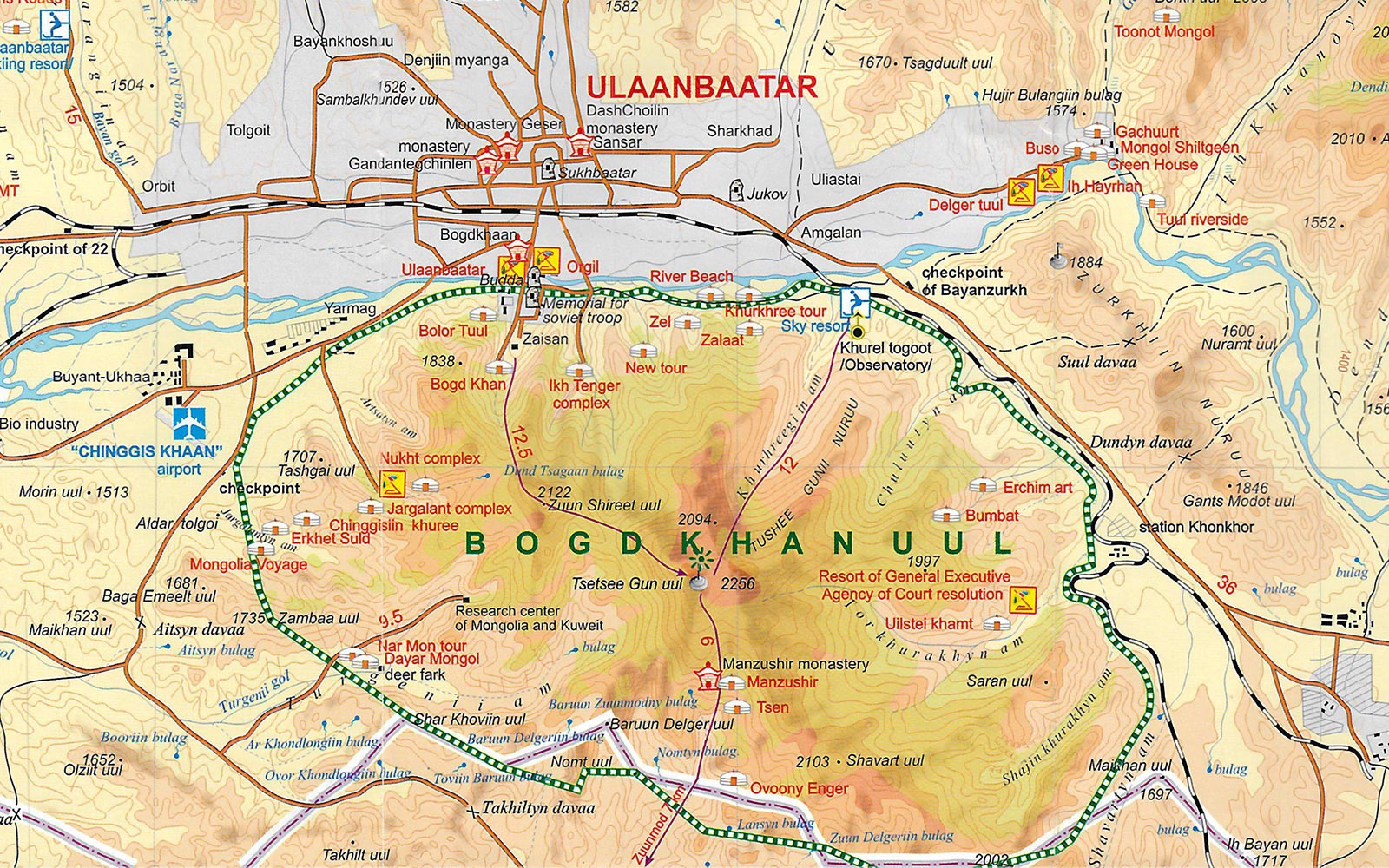
BOGDKHAN NATIONAL PARK
BOGDKHAN UUL

The mountain Bogdkhan Uul (2122m) was proclaimed a national park as far back as 1778. During the Soviet period the park's status was
formalized and it was renamed after Choibalsan. It is now designated the Bogdkhan Uul Strictly Protected Area (42,651 hectares).
UNESCO has also proposed to establish a wildlife park in the region, of up to 65,000 hectares. It seems that early legislation has
ensured that the park won't become part of Ulaanbaatar awful urban sprawl.
The protected area is immediately South of the river, the Tuul Gol, South of Ulaanbaatar and West of Nalaikh.
It surrounds Tsetseegun Uul and contains the Zaisan Memorial,
Nukht and Manzshir Khiid (Manzshir Monastery).
The main activities in the park are hiking and horse riding. The most accessible entrances are via Zaisan, the Ikh Tenger Valley, and from Manzshir. There is another entrance from the camp, Chinggis Khaani Khuree. For information on hiking to the main peak from Zaisan or Manzshir, or combining the two in an overnight hike from Manzshir to
Ulaanbaatar.
FOUR HOLY PEAKS
The 4 peaks surrounding Ulaanbaatar are considered holy. The Tsetseegum, Chingeltei, Songino Khairkhan and Bayansurkh mountains correspond, more or less, to the 4 points on the compass. These peaks are great for hiking, and they're popular for their forests of larch trees, grasslands and stunning bird and other animal life, including red deer, ibex and sable. The forest is the
most southern limit of the Siberian larch forests. There is no shortage of thunderstorms in summer, so be prepared, and there's heavy snow in winter.
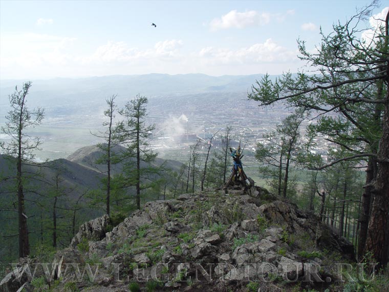
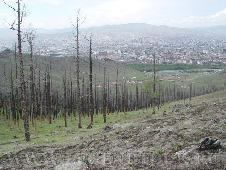
TSETSEEGUN UUL.
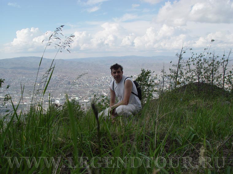
Of the four, easily the most magnificent mountain is Tsetseegun. At 2256m, Tsetseegun is the highest point in the Bogdkhan Uul range, which dominates the skyline to the south of
Ulaanbaatar. From the city, you can't get an idea of just how beautiful this area is, but once you're in the forest it has a whole different feel.
If you are hiking around this mountain, you need a permit - that is, you must pay an admission fee. You can do this at the gate to the Bogdkhan Uul Strictly Protected Area or at
Manzshir Khiid. If you aren't hiking to the mountain through these entrances, you should get a permit from the Protected Areas Bureau in
Ulaanbaatar, though in reality the chances of being checked
are minimal.
There are numerous approaches to the summit, some easier than others, and you may want to go up one way and descend by another route. One popular option is to hike from Manzshir
Khiid to Ulaanbaatar, either to the Zaisan Memorial or the Ikh Tenger Valley. This takes about 10 hours' hiking, so you'll need to camp overnight in the park.
The trip is only sensible from the beginning of June to the end of September. During the rest of the year, no matter how pleasant the weather is in the morning, sudden thunderstorms
and icy winds can come out of nowhere (even during summer). It's important to take a compass and know how to use it, as it's easy to get lost in the forest. You'll need to make an early start and, as
there is little or no water on top of the ridge, carry all the water you will need, plus extra food.
Some scrambling over fields of granite boulders is necessary, and the chance of slipping and injuring yourself should not be taken lightly. It would be wise to inform a friend or
guesthouse owner in Ulaanbaatar of your itinerary and the time of your expected return.
- Manzshir Khiid (Manzshir Monastery).
This approach to Tsetseegun from the South side is the easiest route by far. As you face the monastery, cut over to your right
(East) until you get to the
stream. Just follow the stream until it nearly disappears and then head North. About three hours' walking should bring you out over a ridge into a broad boggy meadow, which you'll have to cross. If
you've walked straight to the North, the twin rocky outcrops of the summit should be right in front of you. When you start to see
Ulaanbaatar in the distance, you're on the highest ridge and close to
the two large ovoo (sacred pyramid-shaped collection of stones) on the summit.
From the ovoo you can return to Manzshir or descend to Ulaanbaatar. If you head down to
Ulaanbaatar it's difficult to find the right way; you'll just have to estimate from your
visual reference of the city. The easiest route takes you to the Ikh Tenger Valley, on the southern fringe of the city, from where you can hitch or take a taxi into the city
center. Beware about
hiking too close to the Presidential Palace, between the Zaisan Memorial in Ulaanbaatar
and the Ikh Tenger Valley, as one reader warns: There is a ring of army guards on the hills surrounding the palace.
- Zaisan Memorial
This is the most scenic route of all, but also the most difficult. It's a good six hours each way and the boulders near the summit make it hard going.
- Shavart Route
Shavart Uul, which appropriately means 'muddy mountain', is a lesser peak of 2003m on the south-east side of
Tsetseegun. As you climb, you'll note seven large
rocks on your left. This route takes five hours in each direction. Getting to the starting point requires a car or taxi.
- Khureltogoot Route
This is the easiest route on the Ulaanbaatar side, mainly because you hit the fewest boulders. However, this route is also the least interesting. The walk
takes about three hours in each direction.
The problem is that getting to Khureltogoot is difficult. At about 8 a.m. every morning a bus for workers at the Astronomical Building in Khureltogoot leaves from the long-distance
bus station in Ulaanbaatar; you may be able to hitch a ride on this. Otherwise, you'll have to take a taxi.
CHINGELTEI UUL.
On the North side of Ulaanbaatar, Chingeltei Uul (1949m) has some pretty forests near the top. You can reach the base of the mountain by bus No 3, 16 or, best of all, 18 from the
center of Ulaanbaatar. By taxi, you can go all the way up to a gate from where it's a 2km walk to the summit.
SONGINO KHAIRKHAN UUL
This small mountain to the West of Ulaanbaatar has the unusual name of 'onion mountain'. There is no bus to it, so you need to take a taxi to the base, passing through a park with
concrete animal statues. Getting back to Ulaanbaatar could be a hassle if you haven't made prior arrangements, though on a Sunday it should be easy enough to hitch a ride.
BAYANZURKH NURUU
The name of this range of peaks to the East of Ulaanbaatar means 'rich heart mountains'. There's a little forest at the top and views from the summit are good. You can reach the base of the
mountains by taking the bus to Nalaikh and getting off before the women's prison. Of the four holy peaks, these are the least impressive.
ADDITIONAL INFORMATION:
PAGES OF THE PICTURE ALBUM
|


 Classic tours