Khentii aimag. Ondorkhaan. Dashdeejetliin monastery. Gundgavirlan monastery. Dadal. Chinggis Statue.
ABOUT MONGOLIA
THE REGIONS OF MONGOLIA
KHENTII AIMAG.
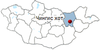
- Territory - 31,004 sq. miles (80,300 sq. km)
- Center - Undurkhan town, located 205 miles
(330 km) from Ulaanbaatar.
- Number of somons - 19
- Khentii aimag was established in 1930.

Khentii aimag is the birthplace of the Great Emperor Chinggis Khaan. It is
situated in a region of great natural beauty, yet only a day's (331 km)
drive from the capital city Ulaanbaatar. It borders in the north with the
Russian Federation.
Hentii is one of the 21 aimags (provinces) of Mongolia. The aimag is set up
in 1923 initially as the
Khan Khentii Mountain aimag with the administrative units consisting of 25
khoshuus, 2 shavis, 109 soums, and 328 baghs (the smallest administrative unit).
At present Hentii aimag has 20 soums and 3 towns with more than 70 thousand
population in total. The ethnic groups Khalkh and Buryad live in this locality.
The territory of the aimag extends over
80 thousand square kilometers. The aimag administrative centre is Underkhaan,
which is ideally located as a gateway to the Eastern Mongolia.
Hentii aimag accommodates part of the giant Khan Khentii Protected Area
covering over 1.2 million hectares of the rugged Hentii mountains, being
bordered with Terelj National Park to west. There are several peaks that rise
over 2000 meters above sea level, with the highest one being Asralt Khaikhan
(2,800 meters).
Khan Khentii mountain range has preserved its original features, and is
located between Eurasian coniferous forest taiga and Central Asian arid steppe.
There are over 70 rivers of a various size, including the three large ones the
Tuul, Onon and Kerulen that have their sources from numerous springs at Hentii
range, where lies the world watershed of three huge drainage basins: the Arctic
Ocean, Pacific Ocean and the Inland Basin of Central Asia. The Tuul flows
northward across the Russian border and into Lake Baikal and on to the Arctic
Ocean, the Onon and Kerulen both flow eastward to join Amur before emptying into
Pacific Ocean.
The climate, soil and landscape change as one goes from the
West to East, The annual perception is about 8-12 inches (200-300 mm).
Hentii aimag is rich in therapeutic hot & cold springs such
as Gurvan nuur, Ono, Avarga toson, Tars and others, used for medical purposes.
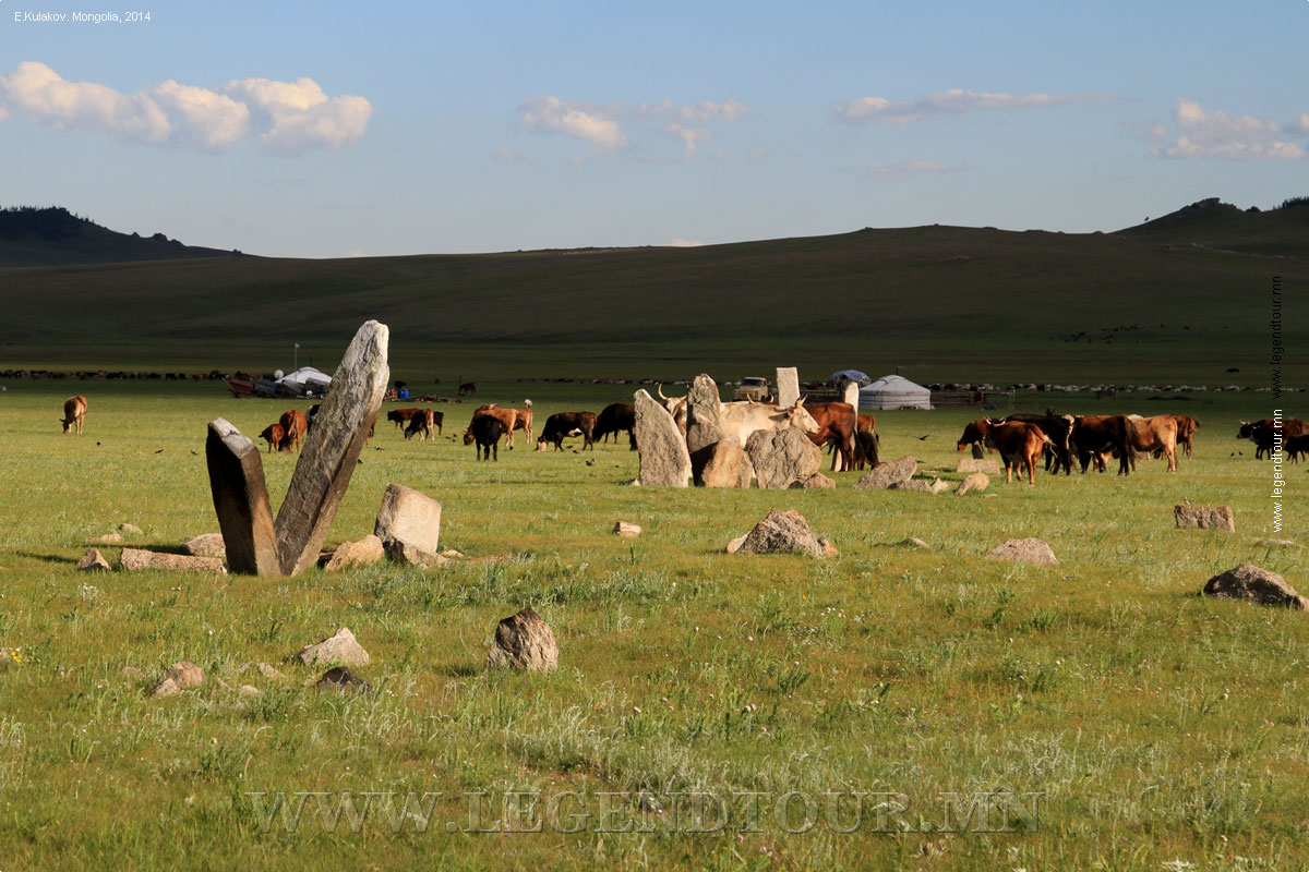
The prime sector of its economy is agriculture, including
animal husbandry. Horses, cows and sheep prevail in the husbandry. The area,
specifically the town of Galsher in the south of the aimag is famous for its
fast horses. The racehorse from this place, known "Elbeg" won the nation-wide
horseracing competition 17 times.
The aimag land exhibits the richest diversity of plant and
animal life. It is rich in wild berries, such as red and black current,
strawberry, blue berry as well as different kinds of medical herbs. Hentii is
home to endangered musk dear and moose, brown bear, wolf, lynx, badger,
wolverine, weasel, sable, roe-deer, elk and squirrels. White gazelle, fox,
steppe fox, marmots and hares come across in plenty in the steppe and grasslands.
There are many species of birds, including whooper swans,
spoonbills, and great white egrets and raptors are found here. The land contains
mineral resources such as gold, silver, smoky quartz, asbestos, tungsten, flour
spar, coal, and iron ore, tin and copper.
Nowadays, Hentii aimag represents one of the tourist
attractions. It has many historical places, especially related to the life of
Chinggis Khaan as he was born, grew up, raised to power, was crowned, and
considered to be buried here. These attractions include Khokh Nuur (Blue Lake)--place
where Temujin was crowned as Chinggis Khaan in 1206, Ikh Aureg (Palace) of
Chinggis Khaan--the site closely connected with the historical work "The Secret
History of the Mongols" (Mongolyn Nuuts Tovchoo) written in 1240, Doloon Boldog
in Kherlen Khuduu-Aral, often mentioned in this masterpiece, Gundgavirlan
monastery built in 1660 and reopened in 1990s, an impressive Chinggis Khaan
Statue in the Gurvan Nuur, built in 1962 to commemorate the 800th anniversary of
his birth, the Galtai Agui ( a 80 meter deep cave), and others.
In addition, there are other places of interest such as stone
pictures, ruins of 13th and 14th century towns, Stone Walls of the Kidan Dynasty,
Hajuu balug and Oglogch walls, Hermen-zam. Baldan Breiven, a Buddhist Monastery
rebuilt in the 1990s, which is very similar to the famous Utai Gumban in Tibet.
PALACE OF CHINGGIS KHAAN
Khuduu Aral is a plain about 30 kilometres long and 20 kilometres wide on the
meander of the Kherlen river, west of the Kherlen Toono, and south of the
mountain of Kherlen Bayan Ulaan , at the altitude of 1.300 m above sea level.
The site of Ikh Aurug (palace) of Chinggis Khaan is on this plain. This site is
closely connected with the historical work "The Secret history of the
Mongols" because it was finished exactly here. To honour the 750th
anniversary of this event , a historic monument was erected here in 1990.
Hereabouts are places such as Doloon Boldog and Shilhentseg, mentioned in "
The Secret history of the Mongols " .
KHAN KHENTII MOUNTAIN RANGE
The Khan Khentii State Protected Area is situated in the territory of Erdene
and Mungunmort soums of Tuv aimag, Batshireet and Umnudelger soums of Khentii
aimag, and Yeruu and Mandal soums of Selenge aimag, with the rivers Kherlen,
Onon, Tuul, Minj and their tributaries. The area encompasses 1,227,074 hectares
of the rugged Khentii mountains, streching from just north-east of Ulaanbaator
to the Russian border. It has been protected since 1992. Khan Khentii mountain
range has preserved its original features and is located between Eurasian
coniferous forest taiga and Central Asian arid steppe. The sources of three
major river systems spring from the protected area: the Tuul which flows to
Russia's Lake Baikal and on to the Arctic Ocean, and the Onon and Kherlen, which
flow East to join Amur before emptying into Pacific Ocean. The Khan Khentii
mountain range represents basic characteristics of a natural zone and includes 5
kinds of landscapes of real taiga. It's also the ancestral home of Chinggis
Khaan.
WATERSHED OF THE WORLD
The peak of Tsogt Chandmana Uul, at the end of the Khentii Mountain Range, is
the world watershed of three huge drainage basins: the Arctic Ocean, Pacific
Ocean and the Inland Basin of Central Asia. This mountain is located only 80
kilometres south of Ulanbaator, with an elevation of 1,854 meters above sea
level.
AVRAGA RIVER
The Avraga is a small river which takes it's source from the mountain of
Kherlen Bayan Ulaan, and falls to the south into the river Kherlen. There is a
spring on the valley of the river Avraga, with a composition including
bicarbonate and carbonic gas. The river was named the Avraga because of the
palace of Chinggis Khaan which was built on it's bank.
BIRTHPLACE OF CHINGGIS KHAN
It is considered that a hill, at an altitude of 1,231 meters above sea level
and located north-west of the center of Binder soum, is the place where Chinggis
Khaan was born.
MEDICINAL LAKE
The lake of Gurvan Nuur Rashaan is located in the center of Dadal soum, at an
altitude of 800 metres above sea level. The waters include sulphur, sodium,
potassium and magnesium. For this reason a health resort has been opened for
people who suffer from cardiovascular, digestive, skin and venereal deseases.
Gurvan Nuur Rashaan is also famous for the first monument to Chinggis Khaan,
erected in 1962.
PLACES TO VISITED.
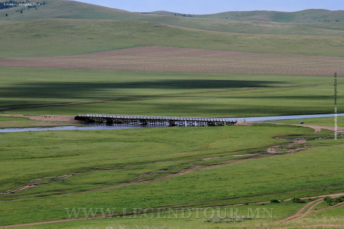
- Kherlen River (also known as Kern or
Kerülen; Mongolian: Хэрлэн гол) is a 1,254 km river in Mongolia and
China. It is also one of the two longest rivers in Mongolia, aside from Orkhon
River.
- Chinggis City (Ondorkhaan). Population 17,000. Eelevation 1027m. The aimag capital, Ondorkhaan, which means 'high king', is in one of the flattest and driest parts of Khentii aimag. The river, the Kherlen Gol, flows through the southern part of Ondorkhaan, however, providing the cattle with water and grass, and the locals (and brave foreigners) with a good swimming hole in the hot summer months. Most of the residents live in wooden buildings, so gers are relatively few in number.
- The Onon river (Mongolian: Онон гол, Onon gol) is a river in Mongolia and Russia. It is 1,032 kilometres (641 mi) long, and has a drainage basin of 96,200 square kilometres (37,100 sq mi).
- Dadal soum. As written in The Secret History of the Mongols, it is now generally accepted that the great Chinggis
Khaan was born at the junction of the Onon and Balj rivers (though his date of birth is still subject to great conjecture). The assumed spot is in Dadal sum (district), near the town of the same name (also known as Bayan Ovoo).
- Galtai Agui. Seventy kilometres north-west of Dadal is the Galtai Agui, a cave set in some beautiful countryside. It is an amazing 80m deep; apparently the deepest in Mongolia. There are also healing rocks in the area called Tsagaan Cholor, which are rich in shamanic lore. The cave is very close to the Russian border, hence you should get permission from the border police.
- Delgerkhaan. Despite the historical significance of the area, there's little to actually see in Delgerkhaan, the sum capital, though it's an easy enough detour to or from Ondorkhaan.
Locals, and some historians, claim that Avarga, not Karakorum, was the first capital of the Mongolian empire. The ancient city is located on a 20km-wide plain, Khodoo Aral (Countryside Island), so named because the area is encircled by the Kherlen and Tsenheriin rivers.
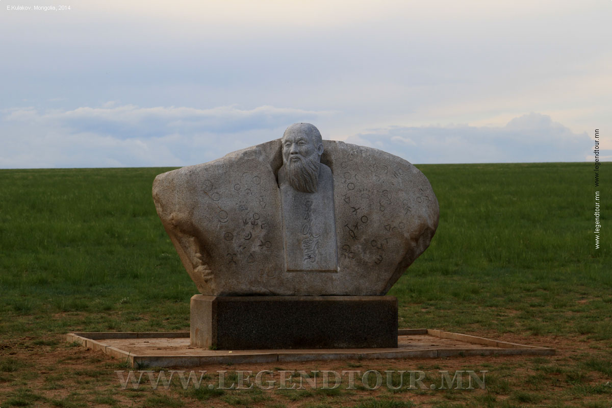
Things to See. The biggest and most impressive of the various statues and monuments in the area is the Chinggis Statue, 13km
South of Delgerkhaan village. It was built in 1990 under the sponsorship of Unesco, to commemorate the 750th anniversary of the writing of The Secret History of the Mongols. The symbols on the side of the statue are the brands used by about 300 different clans in the area for marking their livestock.
One kilometer East of the statue is the Avarga Toson Mineral Spring, from which Ogedei Khaan drank and was cured of a serious stomach ailment. Locals claim the water can cure up to 13 known diseases including ulcers, hepatitis and any pancreatic problems, and acts as a male aphrodisiac.
Between the statue and the spring lie the underground remains of the ancient city of
Avarga.
- Khokh Nuur. About 35km north-west of Tsenkhermandal, the small Khokh Nuur (Blue Lake) is said to be where Temujin was crowned Chinggis Khaan in 1206. There is a small plaque that marks the coronation spot, which some say was attended by 100,000 soldiers. It's not a required stop on the Chinggis Khaan pilgrimage trail but it provides a nice place to break a jeep trip.
A further 30km away is the larger and prettier lake of Khangil Nuur.
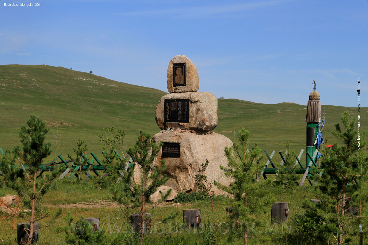
- Baldan Bareven Khiid. This monastery in Omnodelger sum was first built in 1777. At its peak it was one of the three largest monasteries in Mongolia and home to 1500 lamas. It was destroyed by thugs in the 1930s and by fire in the 1970s. Now only ruins remain.
The monastery is currently being restored by tourist-volunteers under the auspices of the American-based Cultural Restoration Tourism Project (CRTP). The project is due to be completed by 2006.
- Burkhan Khaldun. This remote mountain, known as God's Hill, in the Khentii Nuruu is one of the sites mooted as the burial place of Chinggis Khaan. Over 800 burial sites have been found in the region, though the main tomb has yet to be located. Whether or not Chinggis was buried here, The Secret History of the Mongols does describe how the khaan hid here as a young man and later returned to give praise to the mountain and give thanks for his successes.
Because of its auspicious connections, Mongolians climb the mountain, which is topped with many ovoo, to gain strength and good luck. The hill is very remote, in the Khan Khentii Strictly Protected Area. To get there, head to Mongonmorit in Tov, then travel
North along the Kherlen Gol. This is also a great place to reach by horse.
- Ruins of the Uglugchiin Kherem fortress.
It is situated in the Daichin Mountain passing pine and larch forest, 45km
southwest from Batshireet Soum of Khentii province and 8-10km from the
confluence of Ugluch and Bayangol rivers. Uglugchiin Kherem is a fortress of
neatly placed stone propped up against the mountain. It is 2.5-3 meters high,
2.5 meters wide and approximately 3km long.
INFORMATION:
PAGES OF THE PICTURE ALBUM
|


 Classic tours